Evolution of the DoBIH
- The Database of British and Irish Hills
Relative Matters, Issue 7, 2023
- JNSA, LIDAR and the DoBIH
Relative Matters, Issue 6, 2022
- The Database of British and Irish Hills
Submitted to Relative Matters, Issue 5, 2021 but not published in the print magazine
- The Database of British and Irish Hills
Relative Matters, Issue 4, 2020
- The Database of British and Irish Hills
Relative Matters, Issue 3, 2019
- The Database of British and Irish Hills
Relative Matters, Issue 2, 2018 (published with cuts)
- The Database of British and Irish Hills
Relative Matters, Issue 1, 2017 (published with minor editorial changes)
- The Database of British and Irish Hills - past, present and future
Marhofn, May 2016
- The Hills Database – version 14
Marhofn, May 2015
- Towards version 14 of the Hills Database
Marhofn, May 2014
- The hills database version 13
Marhofn, May 2013
- Ten years of the hills database
Marhofn, May 2012
- The hills database version 11.5
Marhofn, May 2011
- The hills database
Marhofn, May 2010
- Graham Jackson talks about the Hills Database
video, Jan 2010
- The hills database
Marhofn, May 2009
|
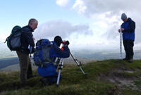
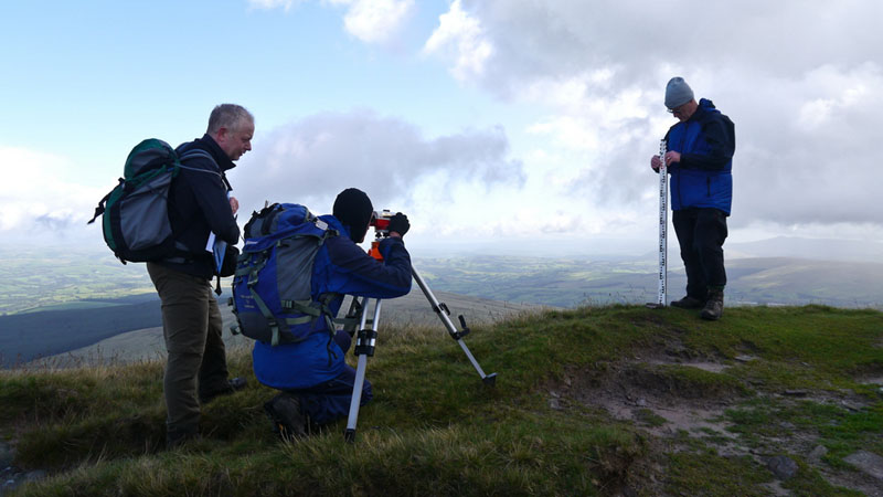
Surveying Fan Brycheiniog
DoBIH 10yr anniversary, 13 Sept 2011
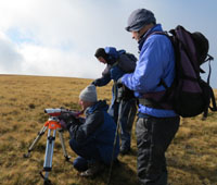
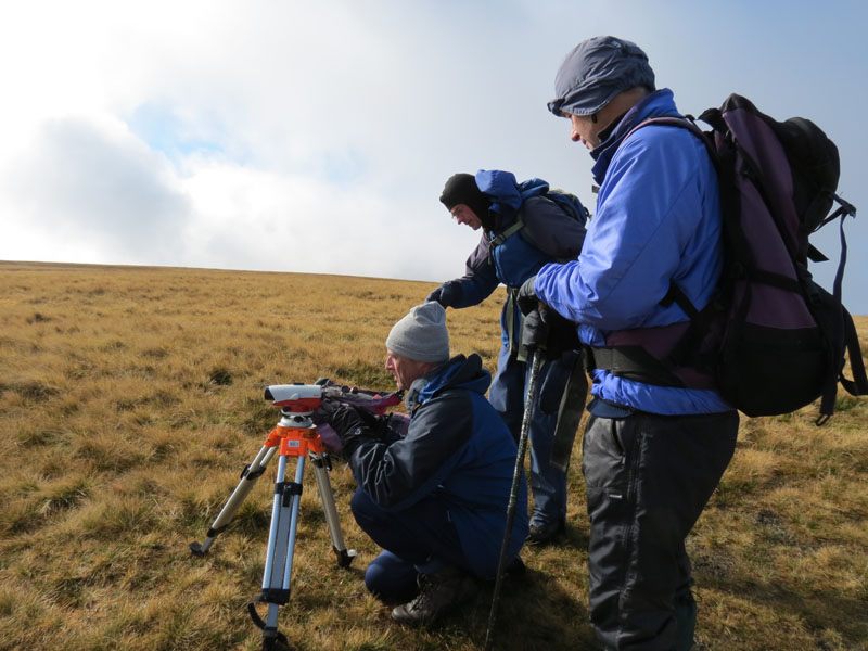
Surveying Wild Boar Fell
DoBIH Editors meeting, 13 Oct 2012
Collecting data on Stac Pollaidh
21 Aug 2018
|
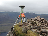
In 2006 two DoBIH editors, John Barnard and Graham Jackson, began to generate accurate hill data using professional surveying equipment. In 2009 they established G&J Surveys to undertake work for other clients. Other hillgoers have since taken up the challenge and the database benefits from their survey data, particularly the many measurements supplied by Alan Dawson in Britain and by MountainViews in Ireland. For details see the Database Notes and the links below.
- Using an Abney Level to Measure Relative Heights
A guide to calibrating an Abney Level and using it to determine the highest point on a hill.
- Determination of the Random Error in Level and Staff Measurements
An experiment to determine the error in height differences measured by an automatic level and staff.
- A performance evaluation – Trimble GeoXH 6000 vs. Leica Viva GS15 Professional
A detailed comparison of the performance of the differential GPS instruments used by MountainViews and the DoBIH survey team, evaluated in a series of surveys carried out over two days in 2013.
- The accuracy of The Munro Society heighting surveys
Article giving technical details of the methods used by the survey team and the accuracy of the measurements. Released after the surveys of Beinn Teallach, Ben Vane, Sgurr a'Choire-bheithe and Sgurr nan Ceannaichean for The Munro Society in 2009.
- The Fisherfields surveys of Beinn a'Chlaidheimh, Beinn Dearg Mor and Ruadh Stac Mor
Report on the heightings for The Munro Society carried out in July 2011.
- G and J Surveys
YouTube channel with clips of surveying projects between 2010 and 2015. Includes a video of the challenging survey of Knight's Peak with the SMC and The Munro Society, media coverage of the surveys of Thack Moor, Snowdon and Knight's Peak, and extended coverage of the press conference on 21 September 2010 to announce the result of the Glydwr Fawr survey (parts 7a-h), with participation of the Snowdonia National Park Authority, Ordnance Survey, UK Metric Association, Gorphwysfa Club and The National Trust.
- Hill surveying part 1: theory
by Graham Jackson, May 2009
- Hill surveying part 2: practice
by John Barnard, May 2009
- Surveying the hills
by John Barnard, May 2008
- Surveying the hills
by John Barnard, May 2007
- Interview with Graham Little of the OS
by Myrddyn Phillips, Dec 2009 (video)
Measurement
-
A statistical analysis of the accuracy of summit and col heights obtained from OS maps, based on a comparison with over 700 accurately surveyed heights. The study covers air survey heights at different map scales, old levelled heights, benchmarks and interpolated heights.
-
An early evaluation of the accuracy of summit and col heights determined by analysis of LIDAR data, published in the 2017 edition of Relative Matters magazine.
-
A scientific and statistical treatment of the sources of error in height measurements by altimeter. A procedure for correcting for temperature and barometric drift is described and tested in the hills. A shortened version, without the maths, was published in TAC43.
Knight's Peak has now been surveyed. This does not change the conclusions in the article.
-
Why doing the 284 Munros gives you only a 21% probability of having climbed all the significant Scottish hills over 3,000ft. A slightly improved version of the author's article in TAC36.
Since the article was written, the heights of all borderline Munros have been measured accurately by surveys commissioned by The Munro Society. Surveys have promoted three hills previously mapped at 609m to the lists of Welsh and English 2000ft summits. Other surveys have created new Marilyns, Humps, Deweys, Nuttalls, Tumps, and one Corbett. We anticipate that the status of all borderline hills in the most popular lists will eventually be established beyond doubt, but in the meantime you should climb the subs!
An examination of Naismith's Rule
Postponed indefinitely: a statistical analysis of hillwalkers' data to test the performance of Naismith's Rule in calculating the time taken to complete a walk, and examine alternative models.
The data were analysed in 2000 but the best fitting models are not very intuitive. For those with a mathematical bent, results are available in Excel from the author.
|